Today, in many research centers and universities around the world, the use of modern technologies is common, which have extraordinary capabilities with very limited costs compared to traditional and classical methods. Sensors have been one of the most prominent symbols of human progress in recent decades, so that it may not be possible to find a science that owes part of its progress to information obtained from satellites.
In the last few decades, the application of new remote sensing technologies, followed by the use of GIS, has created a huge change in the acquisition and exploitation of geological and environmental data. Among the various sciences, Earth-related sciences can be considered as one of the most relevant topics that can be studied and studied for various satellites that orbit the Earth in their complex orbits.
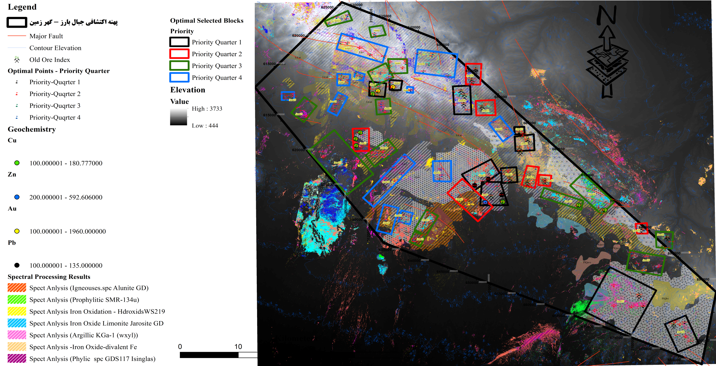
About the application of information received from Satellites in Earth Sciences Various aspects can be expressed, the science of using satellites in geology is so vast and unlimited that the use of multispectral satellite imagery has replaced many traditional and field methods even at the most basic educational levels. .
One of the important and significant features of this science is the wide and integrated view of satellite images and their preparation in the form of hyperspectral information, which allows geologists to study and identify the extension and trend of various geological phenomena, especially deposit formation. Their continuity in the study area and how outcrops and structural features (folds, faults) provide a wide range of studies.
Remote Sensing and GIS Group of Petro Kavir Mahan Company is proud to be one of the most experienced and up-to-date specialized exploration remote sensing working groups by carrying out more than 120 successful exploratory remote sensing projects in the form of private and government contracts. Has.