
The Geology and Exploration Unit of Petro Kavir Mahan Company, with its history of studying and surveying more than 400 mineral areas from the stage of exploration and public exploration to the stages of detailed exploration and modeling and estimation of mineral reserves, has proved its technical ability.
- Geotechnical studies
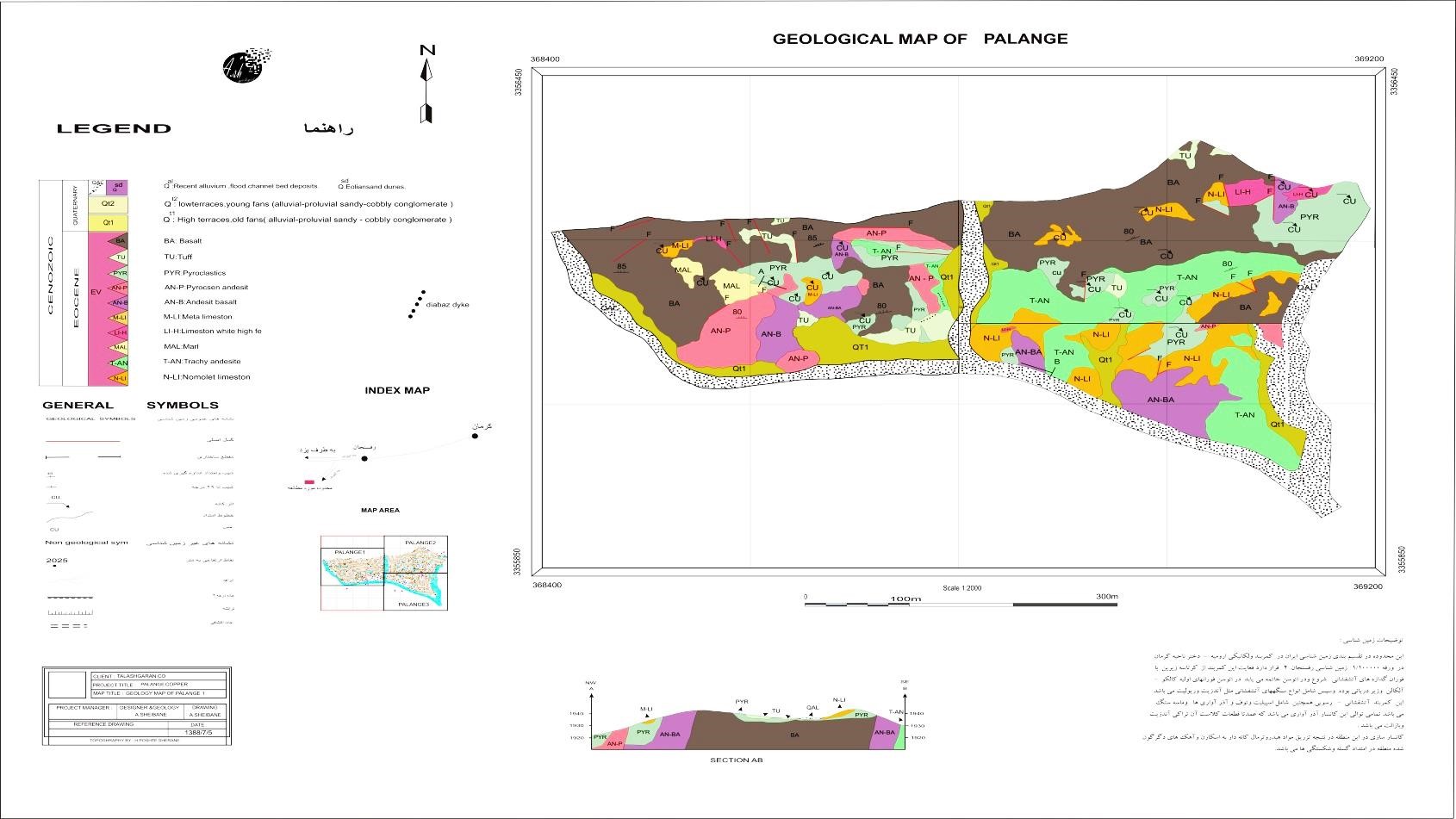
- Preparation of economic geological and structural geological maps in scales of 1: 500, 1: 1000, 5: 1000, 1: 20000 and larger
- Carrying out lithological and mineralogical studies
- Conducting geological, petrographic and mineralogical studies at different scales
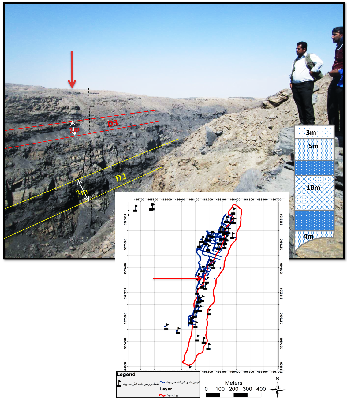
- Design of trench and borehole drilling networks
- Supervising the implementation of drilling-exploration projects
- Study of various types of logs and exploratory boreholes
- Geometric modeling of the distribution of mineral ore in three dimensions within the ground
- Grade modeling and determination of mineral reserves
Example of Exploration Working Group Staged Services:
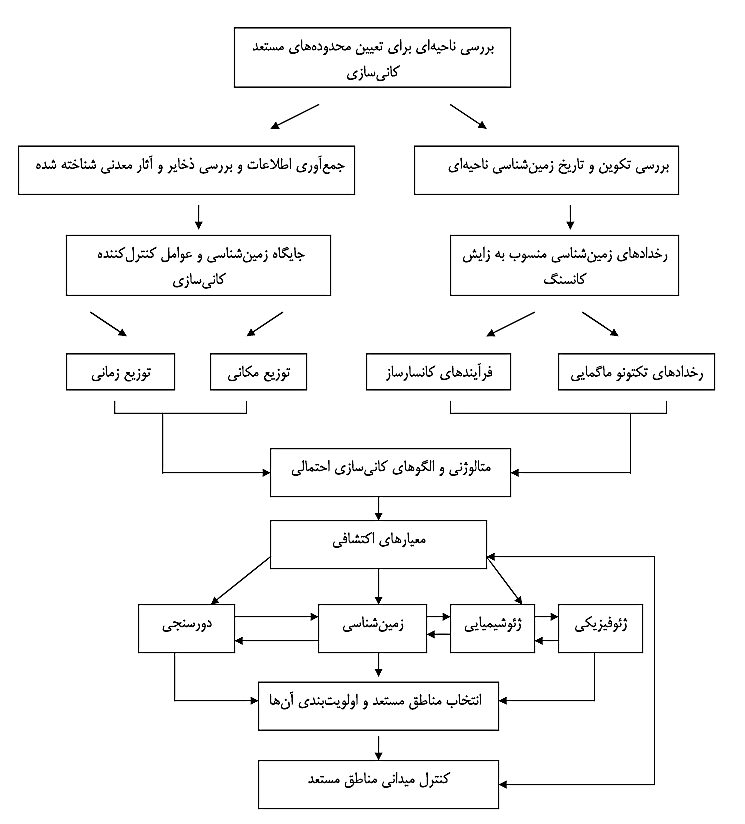
- Gather information and monitor previous exploratory studies, create exploratory databases and pre-process required data
- Block exploratory data based on area boundaries and create independent databases for each area
- Survey, statistical analysis and integration of lithological, satellite, geophysical, structural, watershed, geochemical and morphological layers and provide survey profiles in the form of digital information And visually accurate
- Conduct field studies based on profiles designed in the first phase and sample prone situations
- Find the maximum potential ranges and write and complete the general phase report
- Preparation of thin and polished sections and segmentation and selection of spatial samples for geophysical, geochemical and mineral analysis in the susceptible coordinates of each block
- Evaluate the capability of various geophysical methods in modeling ore development based on the results of previous stage analyzes and designing staged profiles and conducting geophysical studies if approved In the previous steps
- Blocking potential areas resulting from the results of the previous phase and designing the drilling network and constructing trenches and drilling boreholes
- Combining field, geophysical and drilling information performed in the form of modeling the deposit development pattern in three dimensions to a specific depth
- Perform volumetric calculations using optimal model outputs and storage parameters such as the volume of waste required at each point and the degree of storage of each block at the surface Definite trust
- Writing and completing and presenting the final report